MSc thesis project proposal
LIDAR-based autonomous navigation
Assignment
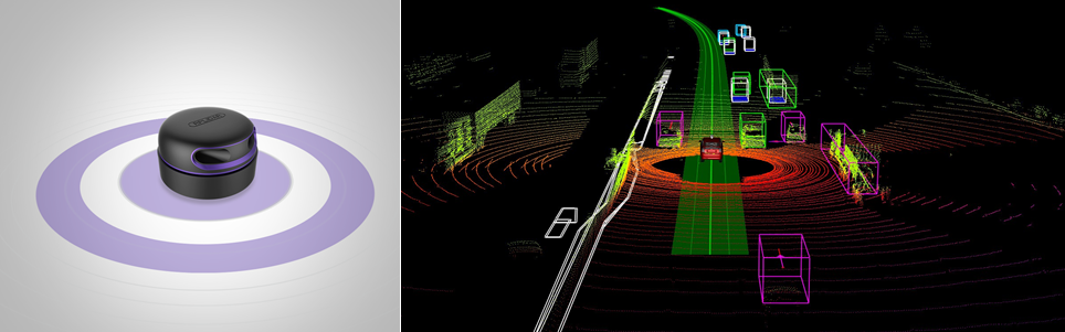
LIDAR (LIght Detection and Ranging) senosrs use light for detecting objects and their distance. A LIDAR emits a light pulse per pixel and records the time that the reflection takes to come back, called ToF (Time of Flight). Given the ToF, it is possible to generate a 3D image of the surroundings, represented by a point cloud. The department of microelectronics actively working with 2 off-the-shelf LIDARs, the data from which will be the starting point for the thesis assignment.An acquisition system in a SoC (System on Chip), including 2 ARM microcontrollers and FPGA, will be available to collect real-time LIDAR data. The aim of this thesis is to process the LIDAR point-cloud data to extract meaningful features and to compress the amount of data to allow its transmission and storage. The algorithmic challenges could include, but not limited to, feature extraction, classification and false alarm mitigation.
The project is in collaboration with David Aledo, and Prof. dr. ir. Rene van leuken.
Image courtesy:
(left) slamtec.com/en/Lidar/A3
(right) medium.com/@olivermitchell/the-five-senses-of-robotics-a94366b1f2ba
Requirements
A self-motivated student with a strong background in either statistical signal processing (along with MATLAB or Python coding skills) or embedded systems design (with SystemC expertise). In addition, a student with experience in LIDAR data processing is preferred. Strong written and verbal communication skills in English is mandatory. The expected project duration is 9 months.Contact
dr. Raj Thilak Rajan
Signal Processing Systems Group
Department of Microelectronics
Last modified: 2021-03-18